A Complete Guide to Hike Mount Agung in Bali
Overview
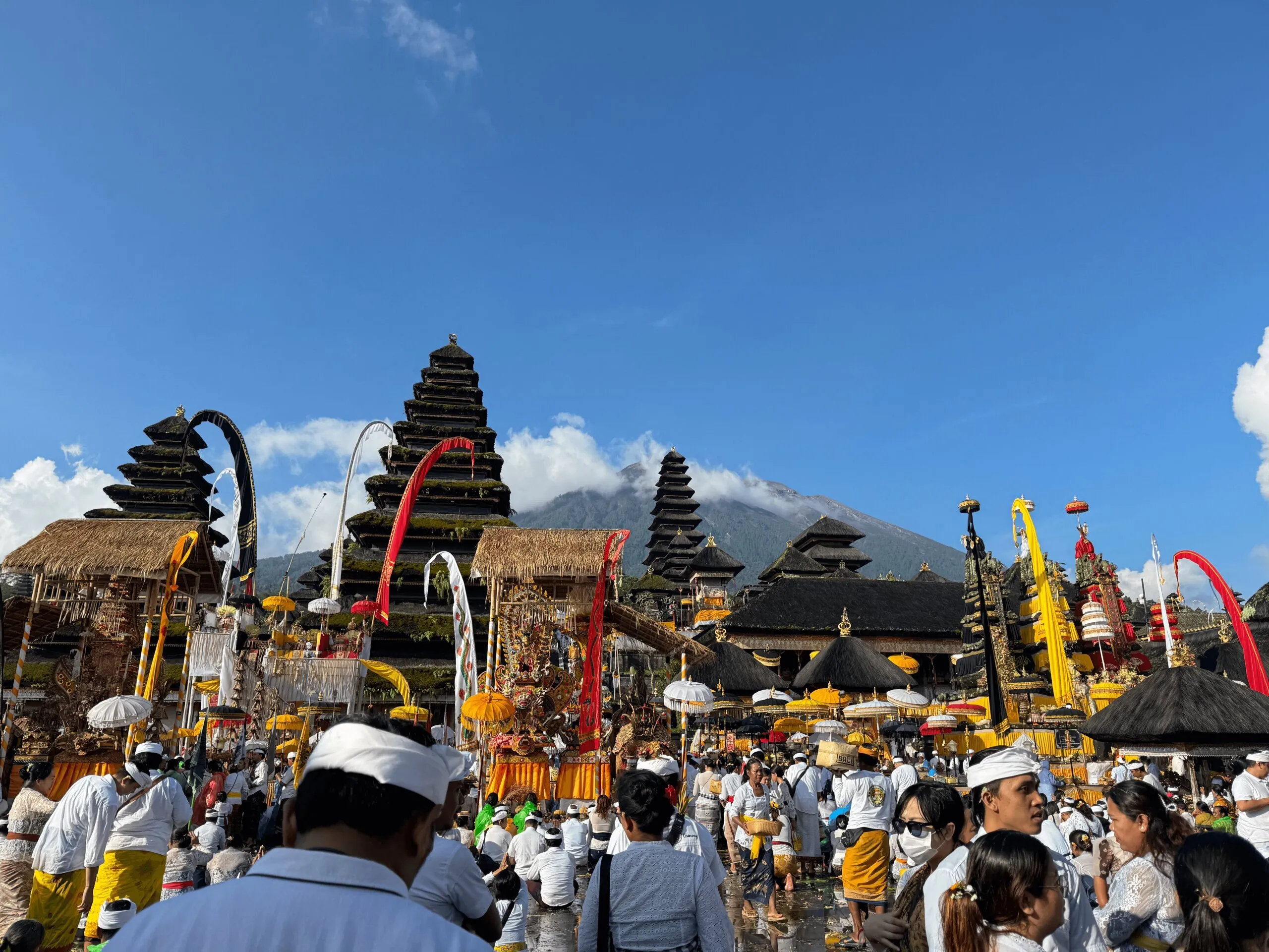
Mount Agung is the highest mountain in Bali, Indonesia, standing at 3,031 meters above sea level. It is an active volcano and is considered sacred by the Balinese people.
The mountain is located in the eastern part of Bali and is a sacred site for Balinese Hindus, who believe it to be the home of the gods.
Unlike the more popular Mount Batur, which is famous among tourists and more accessible, Mount Agung requires a more physical effort to hike which results in fewer crowds and a more serene experience.
Preparing for the Hike
Best Time to Hike
Mount Agung can be hiked year-round, except during the Garung Kuningan ceremony, usually held in March or April.
The best time to hike is during the dry season in Bali, between April and October, which has higher chance of clear skies and less slippery trails. However, it can be hiked during the wet season as well, but be prepared for muddy and slippery conditions.
Be sure to check the news of volcanic status of Mount Agung as it is an active volcano which the last eruption was in 2019.
Routes and Options
There are two main routes to hike Mount Agung:
- Besakih Temple Route:
- Reach to the highest point of Mount Agung
- Elevation gain: ~1,900 meters; Distance: ~13 kilometers; Out and back
- Take about 6-8 hours to reach the summit and 4-6 hours to descend
- Location: Base Camp Gunung Agung Via Edelweis
- Options: Day hike or overnight hike
- Pura Pasar Agung Route:
- Reach the southern side of the summit crater, about 100 meters lower than the highest point
- Elevation gain: ~1,200 meters; Distance: ~6 kilometers; Out and back
- Take about 4-6 hours to reach the summit and 3-4 hours to descend
- Location: Pura Pasar Agung Sebudi
- Options: Day hike
For my experience, I started around 11:30 PM, and reached the summit at 5:50 AM. Took me about 4 hours to descend back to the base camp.
Overnight hike is possible if you preferred a less intense hike. You would start in the afternoon the day before, and camp at Pos 5 (about 2 hour away from the summit), then going back to the basecamp after the summit.
Costs
The cost varies depending on negotiation. I went to this hike alone and didn’t join an open group like Klook, so I paid IDR 1,000,000 for the guide.
I met a Ukraine couple paid the same price for the guide and they got the same price as me. So be sure to negotiate if you are in a group, as the price can be lower per person.
This price isn’t inclusive any transportation as I rented a motorbike and reached the base camp by myself. It would be extra IDR 800,000 for two way private car transportation from Ubud to the base camp.
Booking a Guide
It is required to hire a local guide to hike Mount Agung, there are some stories some people trying to hike without a guide secretly but you probably don’t want to risk it. Read the Mount Batur mafia stories.
For trip booking, I contacted the local guides directly through WhatsApp which I got from the Base Camp Gunung Agung Via Edelweis. Joining open group like Klook can also be an less hassle option.
What to Bring
- Essential Gear: A pair of hiking shoes or at least a short shoes with good grip is a must.
- Clothing: Wear long trousers to protect skin from rocky terrain. Windbreaker or rain jacket just in case of rain or cold wind. It was about 8°C at the summit when I was there, bring a fleece or jacket if you can’t stand the cold.
- Supplies: Pack at least 2 liters of water (I carried 1.8L, was barely enough for me), personal snacks.
Provided by the guide:
- Headlamp
- Trekking poles
- Some light snacks and coffee in POS 3
About the trail
Map and Terrain
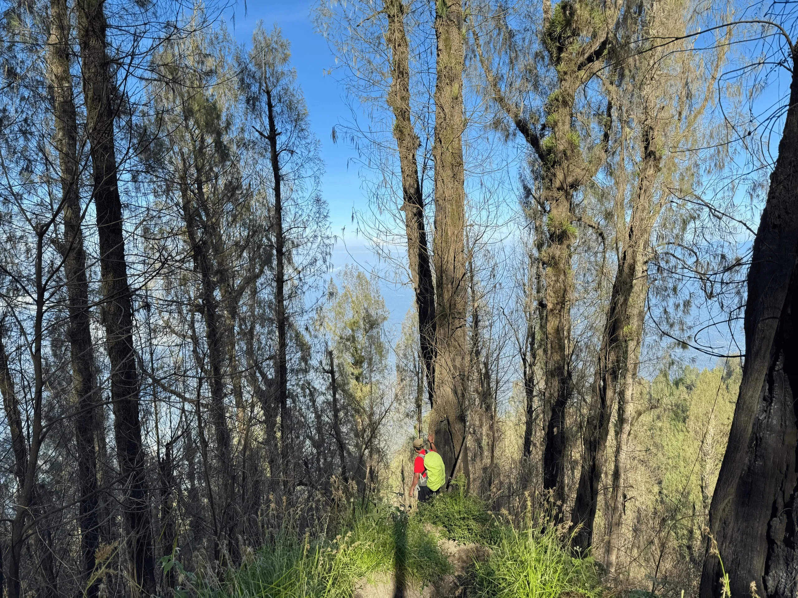
Started from the base camp, first you will walk through the not so dense forest, after about 4 hours and passed the Pos 3, the terrain will be come more rocky with some volcanic sand.
Is it Challenging?
It’s definitely not a chill and easy hike, though not as challenging as the Mount Rinjani, but don’t underestimated it.
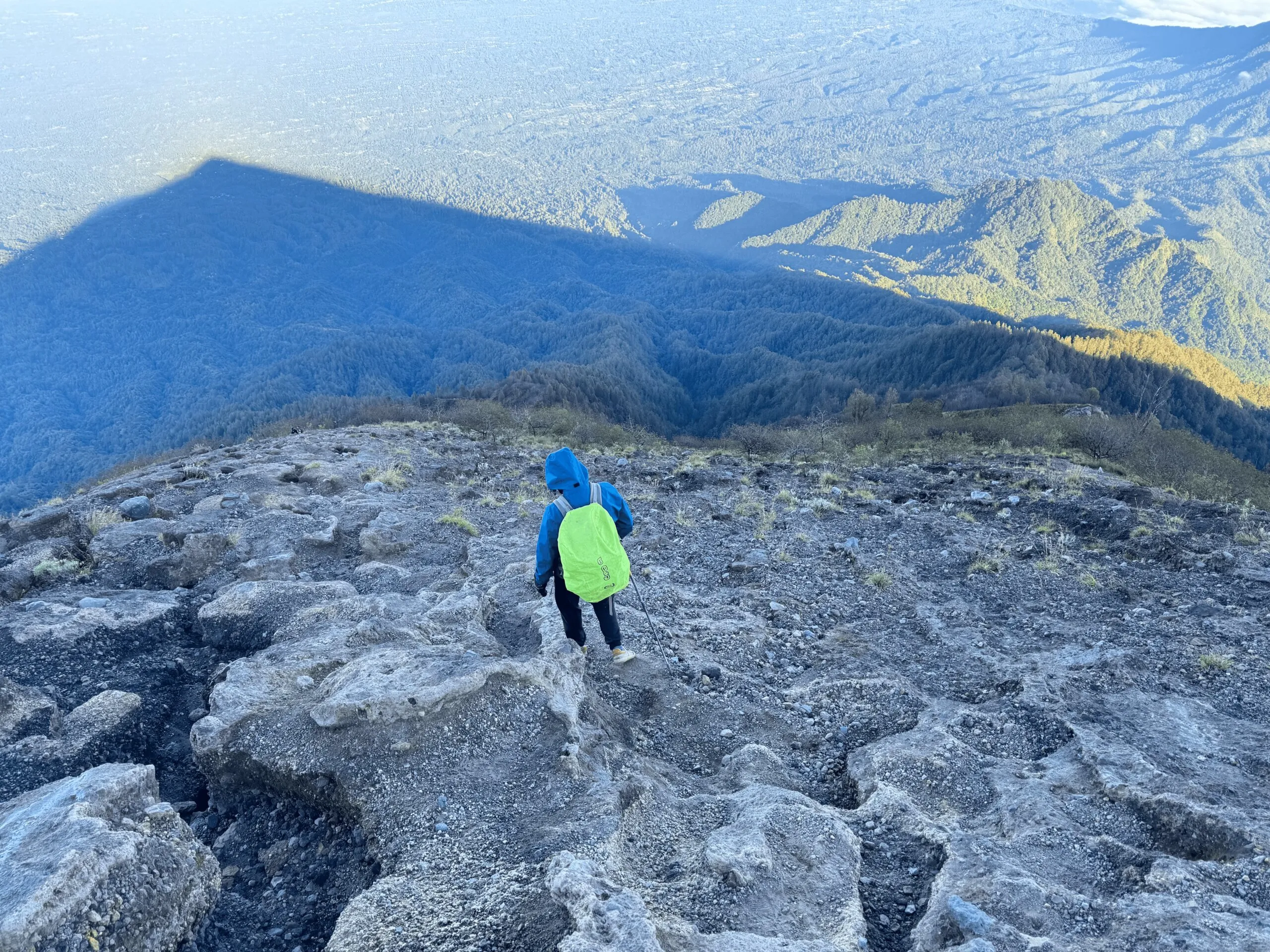
The trail is steep and rocky, most of the time walk in 45° to 60° slope, with very minimal of flat area to rest.
You will need to be comfortable with 10 hours continuous hiking, and be able to walk on rocky terrain with loose rocks.
I feel the descent is more challenging as some parts has loose rocks with small sand on top of it, so you need to be careful with your step, especially when you are tired after the long hike.
Is it Dangerous?
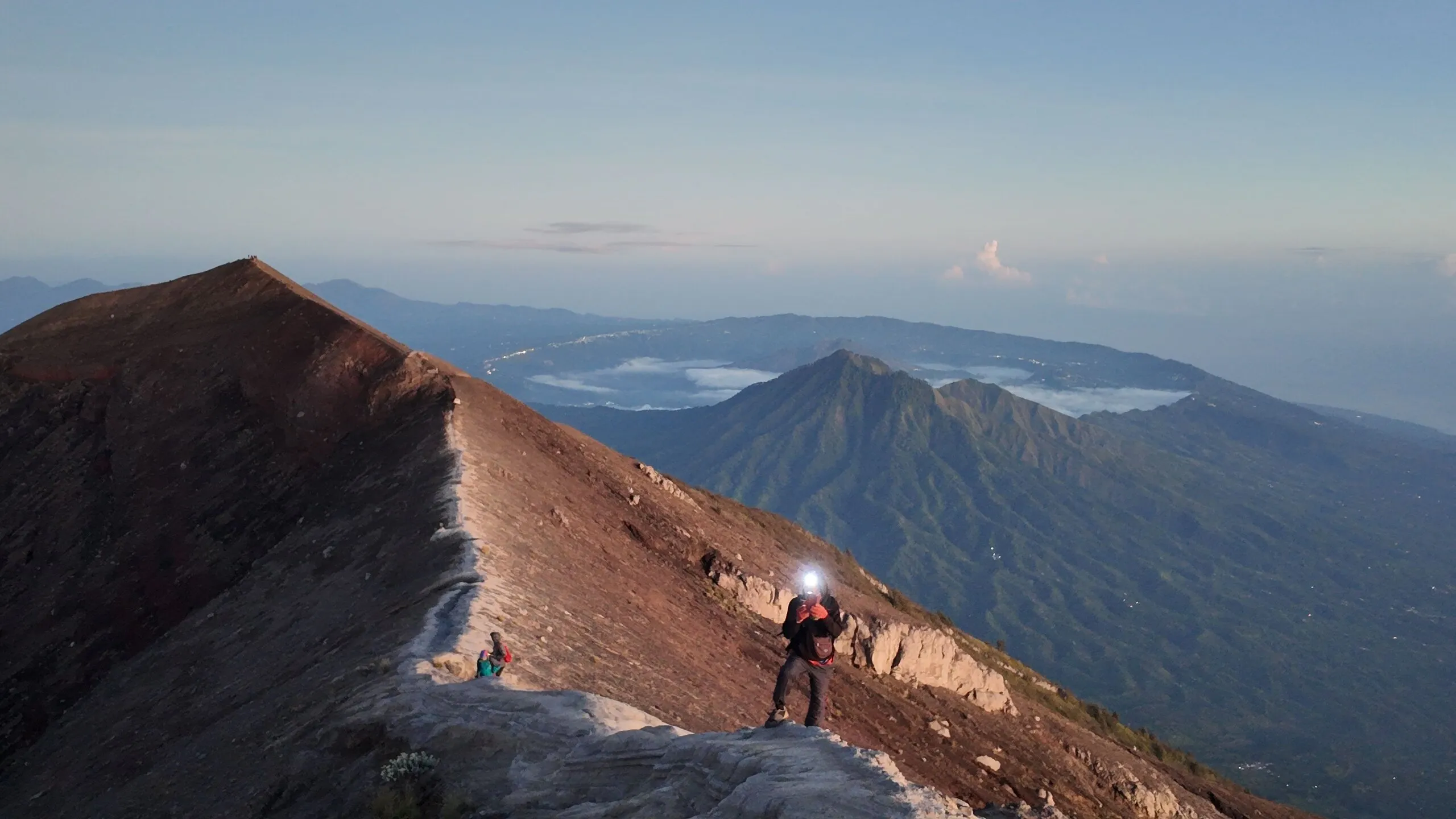
Not really, if you pay attention to your step. Some part of the ridge near to the summit are narrow, if it’s windy or after the rain, you’ll need to be extra cautious.
Is it Crowded?
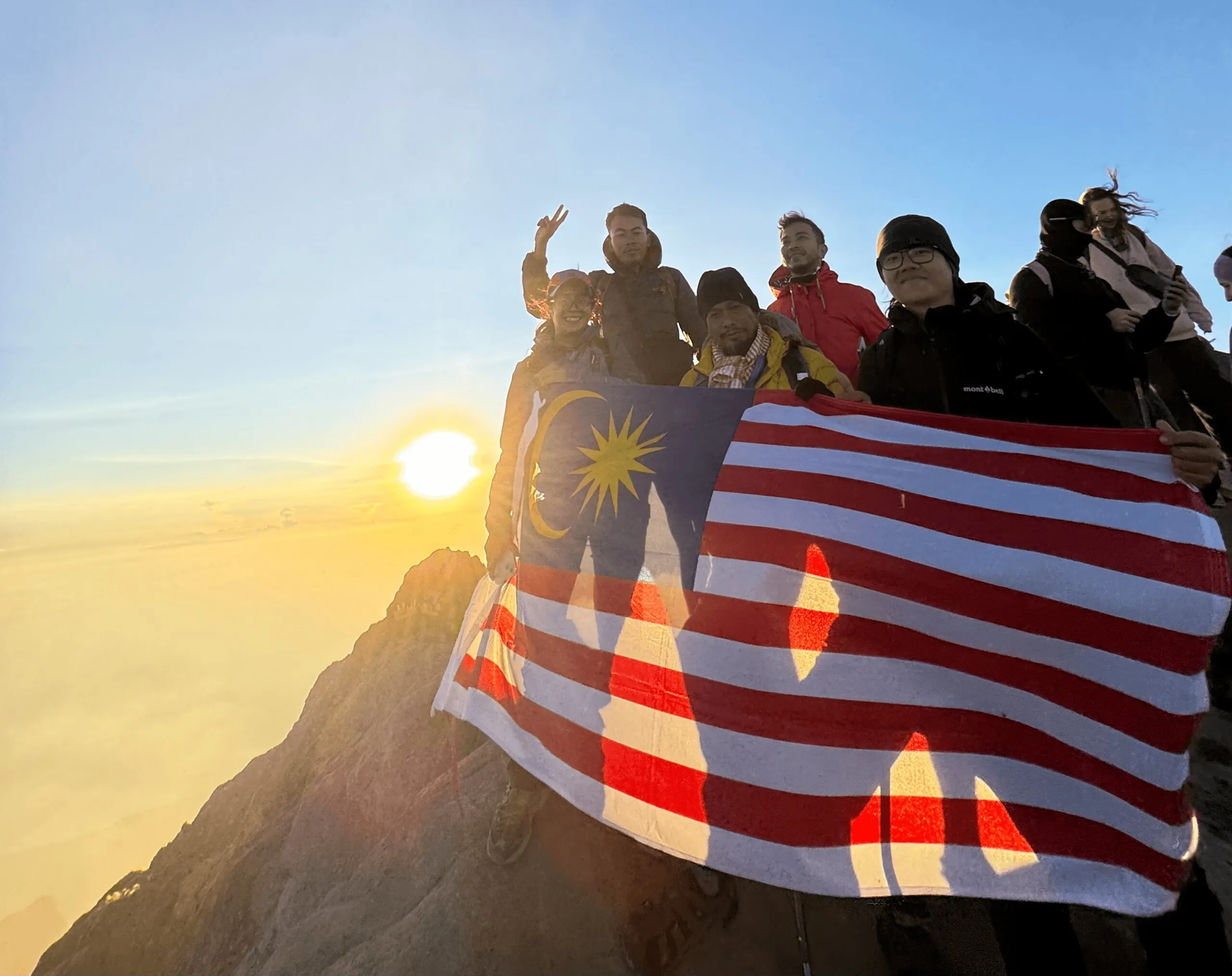
I hike the mountain on the night of 3 May 2025, the first day of the mountain reopened after a month of closure for ceremony. The guide said it was a busy day compared with normal day as it’s first day after a month of closure.
I found it not too crowded, about 50+ hikers on the summit during sunrise time, not too bad compared to other Indonesian mountains I went to. Expect even fewer crowds on weekdays or during the off-season.
Highlights
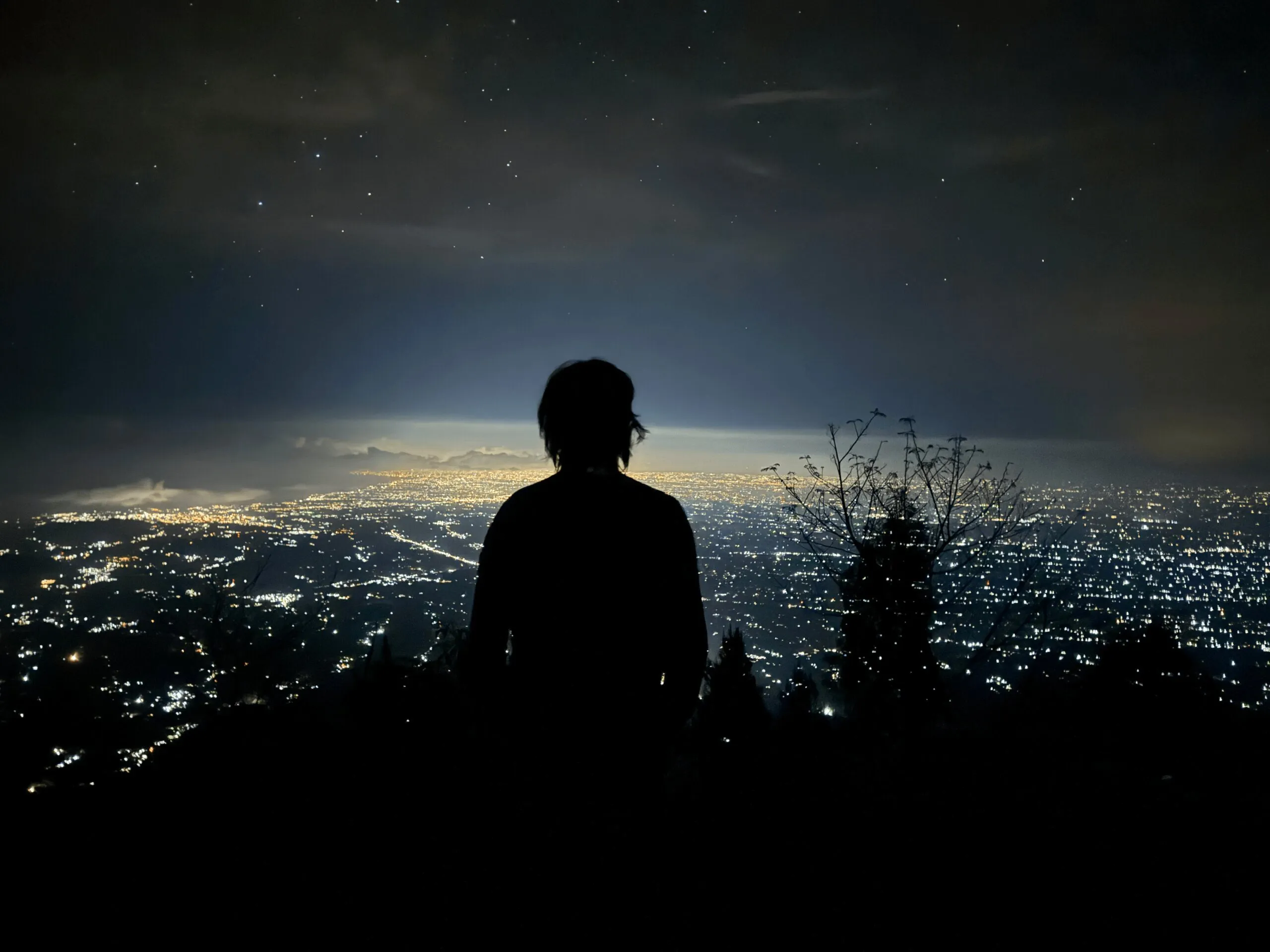
Night views overlooking around the Bali
The best thing start hiking at night is seeing the lights from the villages around Bali with the stars above.
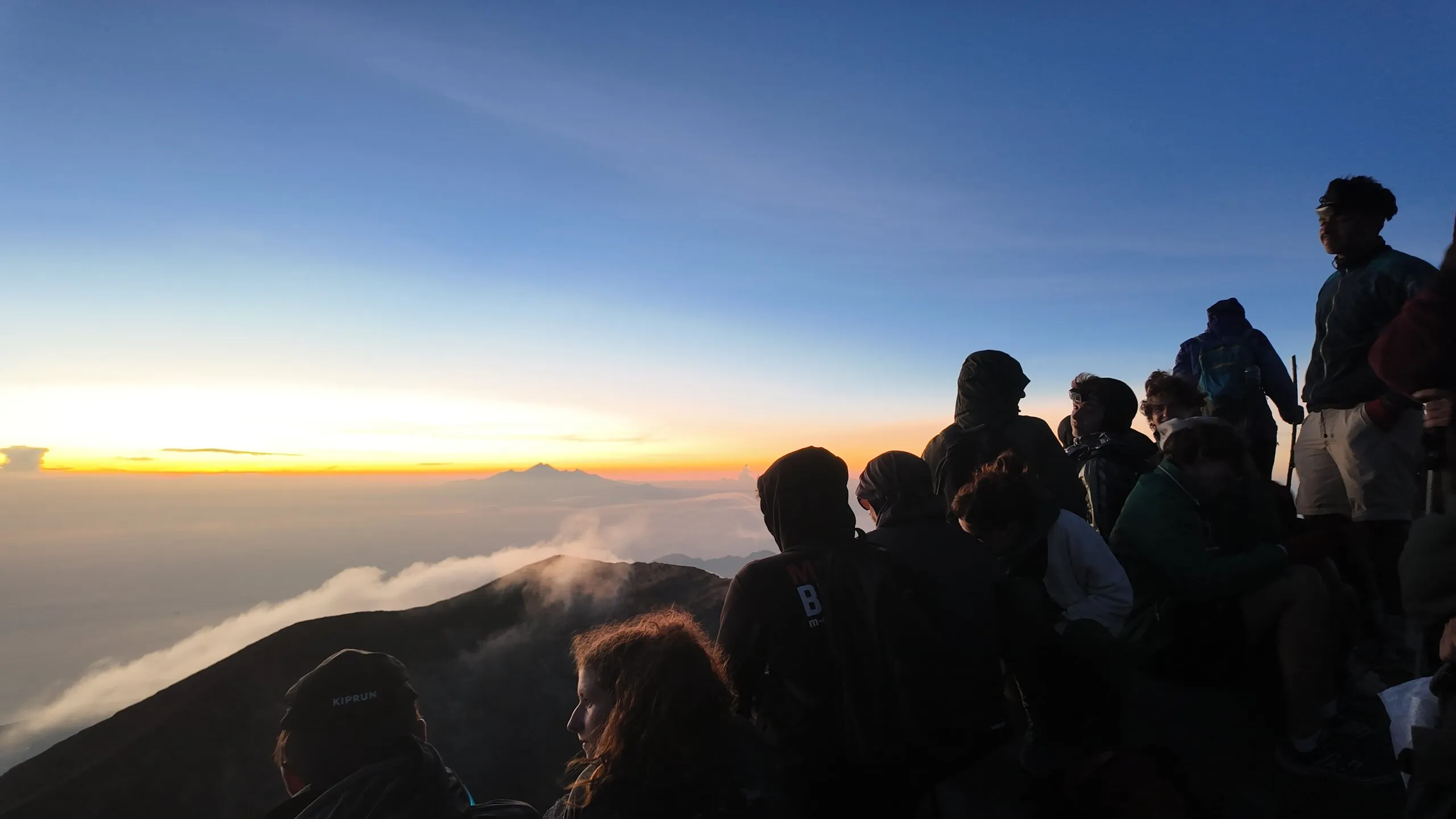
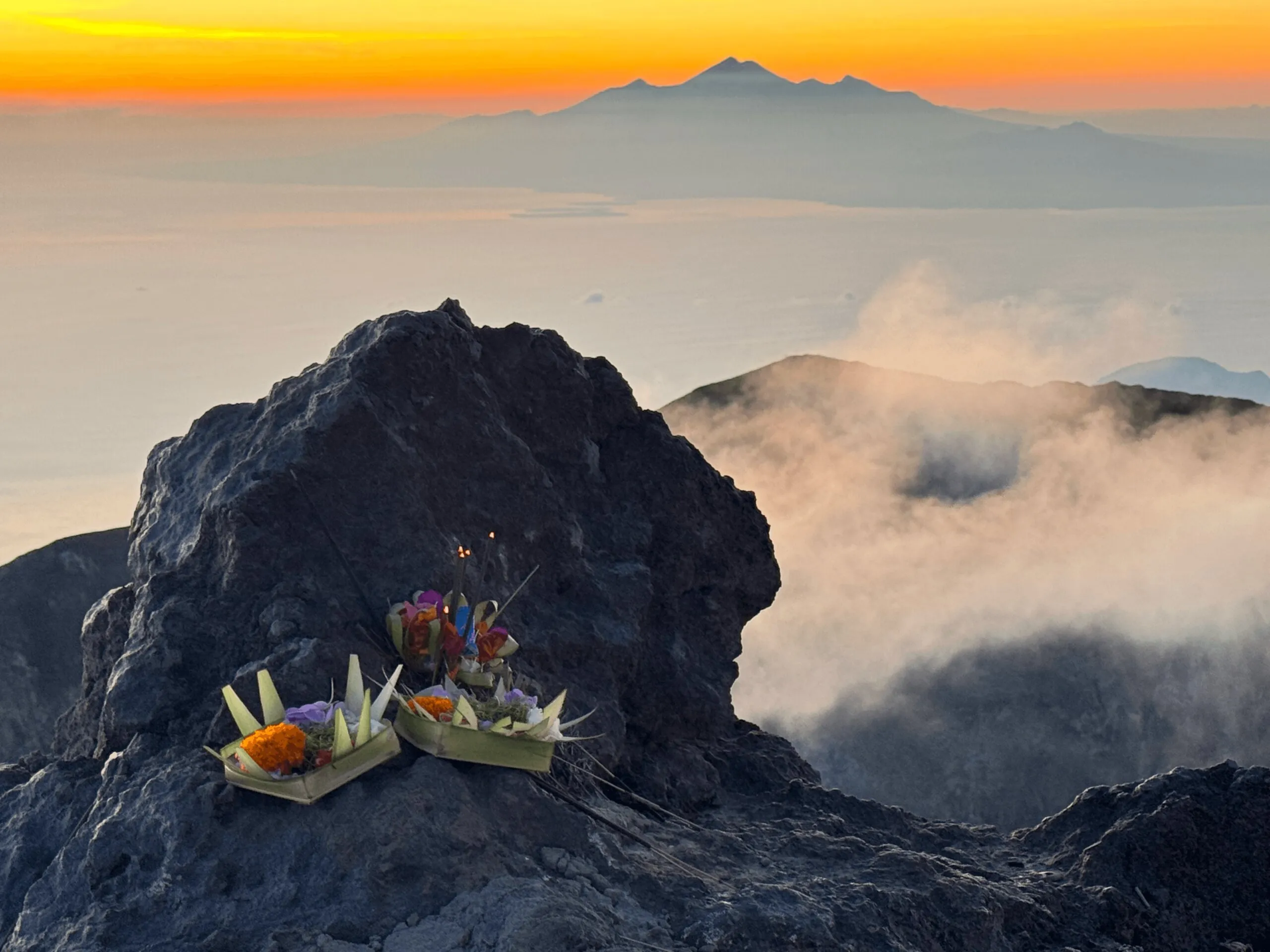
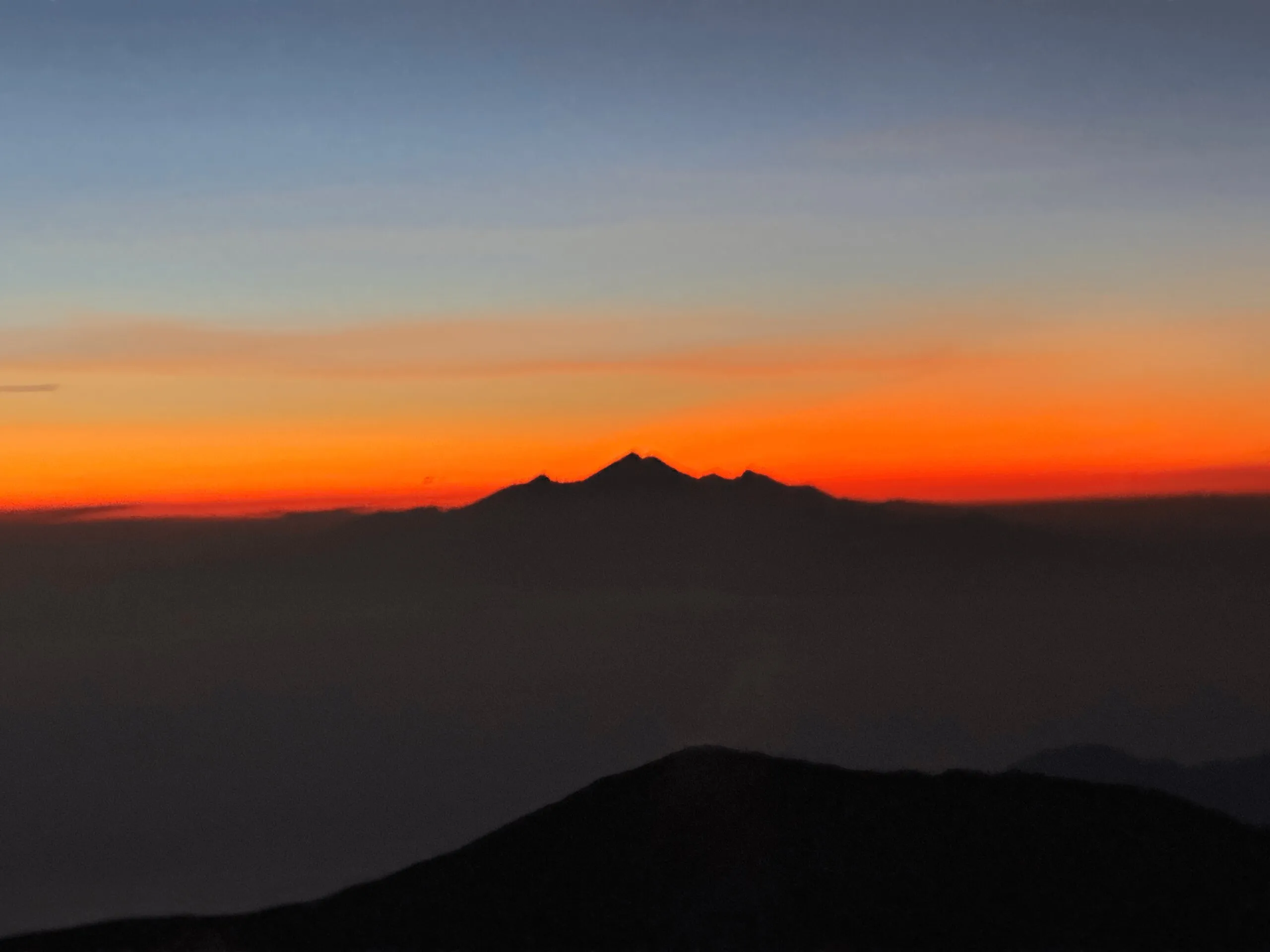
Sunrise and Mount Rinjani
The sunrise view from the summit is breathtaking. The Rinjani was definitely the cherry on top. If you are fan of astronomical lights, be sure to reach the summit at least 30 minutes before the sunrise, the golden light with Rinjani in the background.
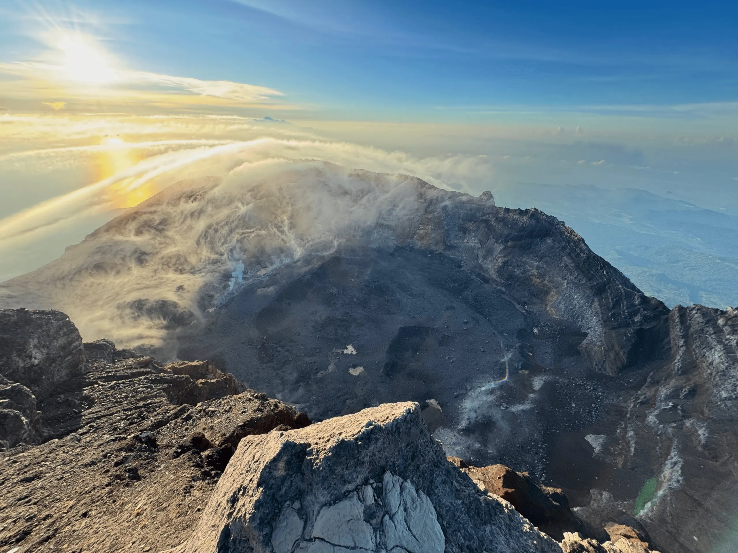
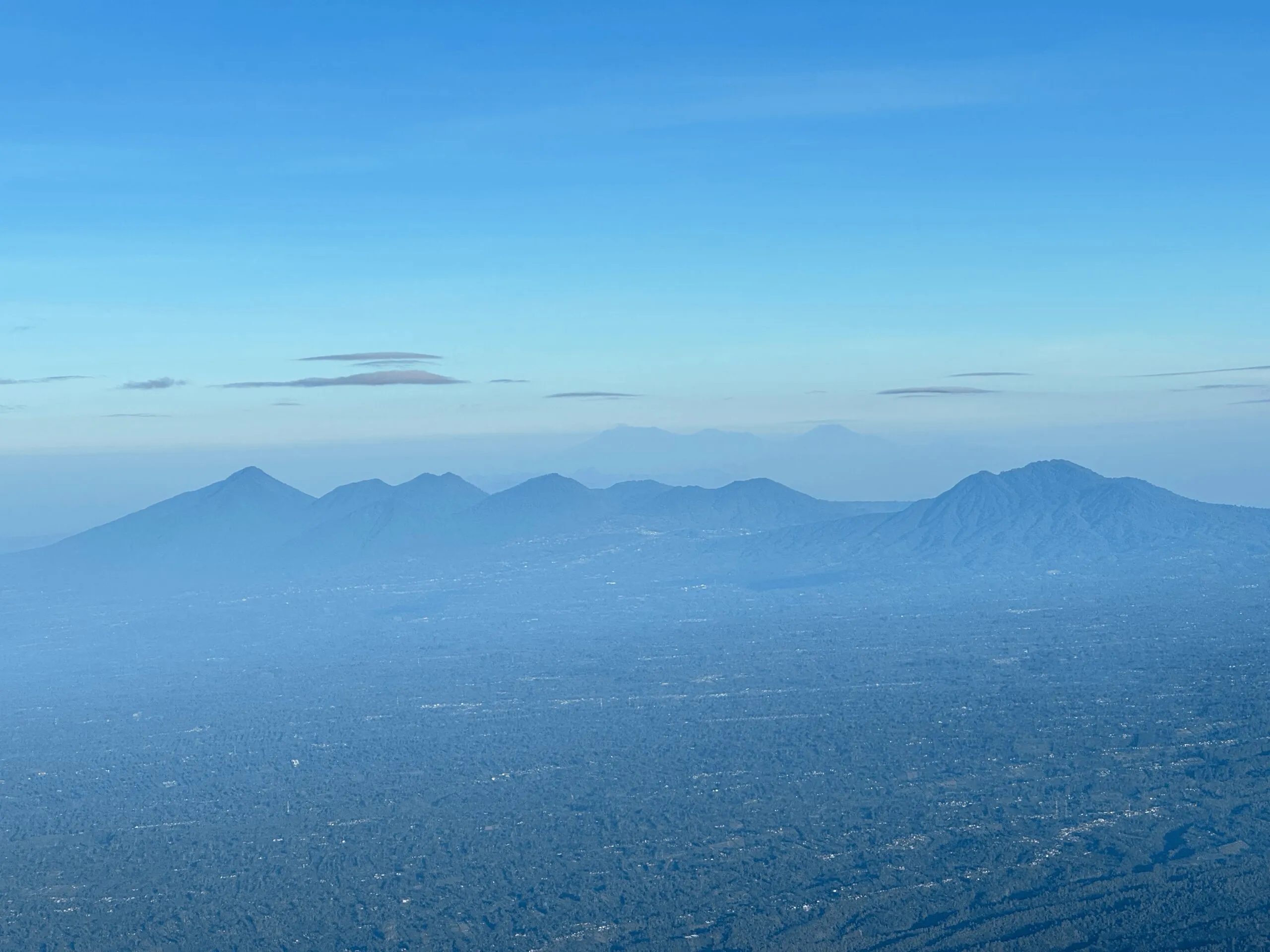
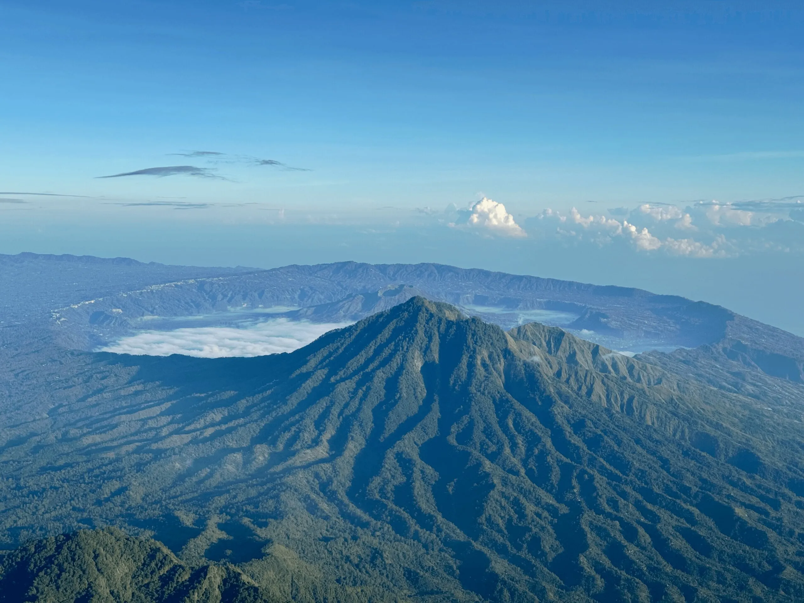
Mount Batur and Lake Batur
From the top of Mount Agung, you can see the Mount Batur and Lake Batur, a very fantasy scene to me. It reminded me a scene from the movie Your Name.
Gallery